Learning Journey Hazard and Risk Assessment: Part 2
Risk Assessment, March – May 2024
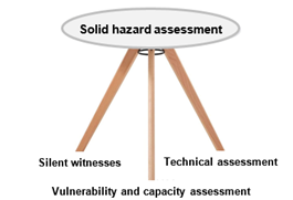
Sound DRR programming relies on having solid assessment data. The data world is in a very dynamic stage, airborne data becomes increasingly accessible. More and more, organisations working in DRR, CCA and resilience strengthening need solid, technical assessments to complement a community-based approach. This is particularly the case for preventive measures. In order to support its member organisations, the Swiss NGO DRR Platform decided to organise a learning journey on hazard and risk assessment.
Objective
Enhance the capacity of practitioners on how to independently conduct a hazard and risk assessment, including how to retrieve airborne data and work with GIS, and determine the cost-benefit ratio of a DRR measure.
Structure
The learning journey is organised in a modular way and conducted over a period of 2 years. The modules are grouped in the following packages:
- GIS, Satellite Data, Drones
- Hazard Assessment
- Risk Assessment and Cost-Benefit Analysis
For details, see the training concept.
Programme of part two
While the first year focused on hazard assessment, the second year will expand to risk assessments and cost-benefit analyses, as well as the visualisation and analysis using GIS. The five modules will be conducted in form of webinars of 2 hours each, on Wednesdays from 13.00 – 15.00h CE(S)T. The dates and topics are as follows:
| Date | Topic |
|---|---|
| 06.03.24 | 1. Introduction to risk assessment, incl. summary of hazard assessment in programming |
| 20.03.24 | 2. Quantitative risk assessment and cost-benefit analysis (CBA) – the concept |
| 17.04.24 | 3. Quantitative risk assessment and CBA – the practice |
| 15.05.24 | 4. GIS – data generation, starting a GIS project and introduction to Open Street Map |
| 29.05.24 | 5. GIS – data analysis and visualisation |
Target Audience
The learning journey is aimed at persons working in the field of DRR in programme countries as well as in head offices (in Switzerland and elsewhere). It is primarily geared towards employees of member organisations of the Swiss NGO DRR Platform but open to interested persons from non-member organisations.
Important: Part two builds on the learnings of part one on hazard assessment that was conducted in 2023. To get the best possible learning experience, we recommend participants who have not attended the first part, to complete the following modules in self-study online:
- 1. Introduction to hazard assessment
- 3. Hazard assessment flood
- 5. Hazard Mapping Flood – Hazard Assessment in Programming
Click here for details of part one, including the recordings and presentations of the webinar modules.
Organisation
The learning journey is organised and facilitated by Andrea Blindenbacher and Georg Heim.
- Andrea Blindenbacher has a MSc in Geographic Information Systems and Remote Sensing and has extensive experience in aerial data acquisition, processing and analysing. Andrea is responsible for package 1.
- Georg Heim is a geomorphologist by background with a MSc in Geography. He has extensive experience in hazard and risk assessments, planning and realisation of mitigation measures. Georg is responsible for packages 2 and 3 and the overall organisation of the training course.
The Swiss Red Cross supports the facilitators and oversees logistics, administration and financial issues.
Further information
- For content matter: Georg Heim
- Administrative issues: Anton Jöhr

